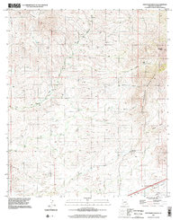
1996 Map of San Pedro Ranch
USGS Topo · Published 2002About this map
The Little Dragoon Mountains dominate this high-desert landscape in Cochise County, rising above a network of drainages that define the local topography. The namesake San Pedro Ranch sits in the lower elevations, surrounded by notable landforms like Sheep Basin and the Johnny Lyon Hills. The map details a transition from the rugged mountain slopes to the alluvial fans of the Tres Alamos Wash, which cuts across the northwestern portion of the quadrangle.
Find a feature on this map
17 named features on this map. Tap any name to fly to it.
Don’t see what you’re looking for? This feature index may not catch every label — zoom into the map to look around manually.
Map Details
Editions of this 1996 San Pedro Ranch Map
This is the sole edition of this map. No revisions or reprints were ever made.
Other maps of this area

1915 · Benson
USGS Topo · 1:125,000

1922 · St. David
USGS Topo · 1:62,500

1926 · Whetstone
USGS Topo · 1:62,500

1943 · Benson
USGS Topo · 1:125,000

1943 · Dragoon
USGS Topo · 1:62,500

1945 · Happy Valley
USGS Topo · 1:62,500

1956 · Nogales
USGS Topo · 1:250,000

1956 · Tucson
USGS Topo · 1:250,000

1958 · Nogales
USGS Topo · 1:250,000

1958 · Tucson
USGS Topo · 1:250,000