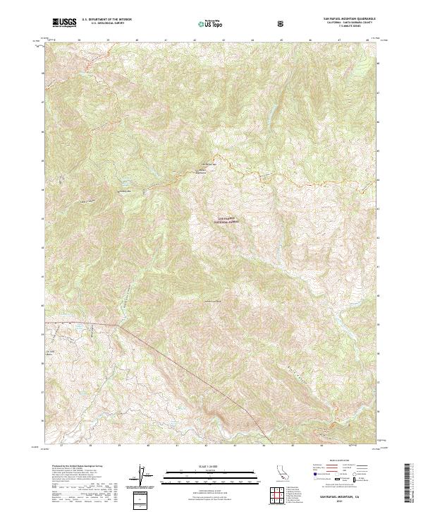
2021 Map of San Rafael Mountain
USGS Topo · Published 2021About this map
San Rafael Mtn serves as the focal point for this section of the Los Padres National Forest, marking a high point in the San Rafael Mountains. The landscape is defined by its complex drainage systems and traditional pack trails, such as the Manzana Trl and Mission Pine Trl, which follow the contours of high ridges and deep canyons. Water sources are critical identifiers in this environment, with several mapped locations including Mine Canyon Spring, Live Oak Spring, and Demesio Spring providing essential waypoints for navigation.
Find a feature on this map
32 named features on this map. Tap any name to fly to it.
Don’t see what you’re looking for? This feature index may not catch every label — zoom into the map to look around manually.
Map Details
Editions of this 2021 San Rafael Mountain Map
This is the sole edition of this map. No revisions or reprints were ever made.
Other maps of this area

1902 · Santa Ynez
USGS Topo · 1:125,000

1905 · Santa Ynez
USGS Topo · 1:125,000

1941 · San Rafael Mtn.
USGS Topo · 1:62,500

1941 · McPherson Peak
USGS Topo · 1:62,500

1942 · San Rafael Mtn.
USGS Topo · 1:62,500

1942 · Little Pine Mountain
USGS Topo · 1:24,000

1943 · Big Pine Mountain
USGS Topo · 1:31,680

1943 · San Rafael Mtn.
USGS Topo · 1:62,500

1943 · McPherson Peak
USGS Topo · 1:62,500
1944 · Salisbury Potrero
USGS Topo · 1:31,680