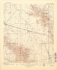
1917 Map of San Simon
USGS Topo · Published 1948About this map
San Simon Creek bisects this high desert landscape during the mid-1910s, a period when the Southern Pacific railroad served as the vital artery for small Arizona settlements like Bowie and San Simon. To the south, the Chiricahua Mountains rise sharply within the Chiricahua National Forest, housing the site of Old Fort Bowie. This area reveals an economy transitioning from frontier defense to extraction and ranching, evidenced by the Marble Quarries near Bowie Mtn and the isolated National Mine on the New Mexico border.
Find a feature on this map
111 named features on this map. Tap any name to fly to it.
Don’t see what you’re looking for? This feature index may not catch every label — zoom into the map to look around manually.
Map Details
Editions of this 1917 San Simon Map
3 editions found
Other maps of this area

1916 · Pearce
USGS Topo · 1:125,000

1917 · San Simon
USGS Topo · 1:125,000

1917 · Chiricahua
USGS Topo · 1:125,000

1918 · Pratt
USGS Topo · 1:62,500

1919 · Pratt
USGS Topo · 1:62,500

1919 · Chiricahua
USGS Topo · 1:125,000

1922 · Willcox
USGS Topo · 1:125,000

1926 · Light
USGS Topo · 1:62,500

1926 · Cochise Head
USGS Topo · 1:62,500

1926 · Rodeo
USGS Topo · 1:62,500