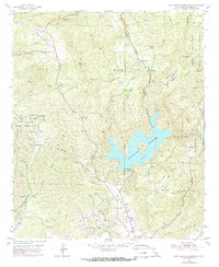
1955 Map of San Vicente Reservoir
USGS Topo · Published 1973About this map
The San Vicente Reservoir and its surrounding canyonlands reflect the mid-century water management and infrastructure expansion of San Diego County. This 1955 survey, with updates from 1971, highlights the critical path of the San Diego Aqueduct and the Tunnel Aqueduct, which cut through the steep topography of Iron Mtn and Vallecitos. The landscape is a mix of agricultural legacies and military influence, bordering the Camp Elliott Naval Reservation to the west and the Barona Indian Reservation to the east.
Find a feature on this map
48 named features on this map. Tap any name to fly to it.
Don’t see what you’re looking for? This feature index may not catch every label — zoom into the map to look around manually.
Map Details
Editions of this 1955 San Vicente Reservoir Map
4 editions found
Other maps of this area

1893 · El Cajon
USGS Topo · 1:62,500

1893 · Escondido
USGS Topo · 1:62,500

1901 · Elcajon
USGS Topo · 1:62,500

1901 · Escondido
USGS Topo · 1:62,500

1901 · San Luis Rey
USGS Topo · 1:125,000

1903 · Cuyamaca
USGS Topo · 1:125,000

1903 · La Jolla
USGS Topo · 1:62,500

1903 · Elcajon
USGS Topo · 1:62,500

1903 · Ramona
USGS Topo · 1:125,000

1904 · Southern California Sheet No. 2
USGS Topo · 1:250,000