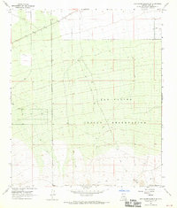
1968 Map of San Xavier Mission SW
USGS Topo · Published 1970About this map
The San Xavier Indian Reservation occupies the central and southern portions of this 1968 field-checked landscape, where the high desert terrain transitions from the open Avra Valley into increasingly complex topography. Settlement is sparse, characterized by isolated sites such as J Bar M and Huff, which sit alongside a network of primitive transportation routes including the Sandario Road and various unnamed Jeep Trails.
Find a feature on this map
10 named features on this map. Tap any name to fly to it.
Don’t see what you’re looking for? This feature index may not catch every label — zoom into the map to look around manually.
Map Details
Editions of this 1968 San Xavier Mission SW Map
2 editions found
Other maps of this area

1920 · Arivaca
USGS Topo · 1:125,000

1925 · Samaniego Peak
USGS Topo · 1:62,500

1925 · San Xavier
USGS Topo · 1:62,500

1934 · Tucson Mountains
USGS Topo · 1:125,000

1939 · Twin Buttes
USGS Topo · 1:62,500

1940 · Palo Alto Ranch
USGS Topo · 1:62,500

1941 · Twin Buttes
USGS Topo · 1:62,500

1941 · Cocoraque Butte
USGS Topo · 1:62,500

1943 · Cocoraque Butte
USGS Topo · 1:62,500

1943 · Palo Alto Ranch
USGS Topo · 1:62,500