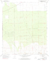
1968 Map of San Xavier Mission SW
USGS Topo · Published 1978About this map
The San Xavier Indian Reservation dominates this southwestern Pima County landscape, capturing a transition from the lower Avra Valley into more varied terrain. In the late 1960s, this area was characterized by wide-open desert land with sparse human imprints, largely defined by ranching and traditional land use. Remnants of rural activity are visible at Cottonwood Ranch, located near the southern boundary, and the J Bar M to the north. A network of Jeep Trails and unnamed trails crisscross the reservation, reflecting a period before significant modern development reached this portion of the Sonoran Desert. Infrastructure is limited to essential water management features such as a Water Tank and scattered Wells, while Sandario Road provides the primary north-south transit corridor through the valley floor.
Find a feature on this map
12 named features on this map. Tap any name to fly to it.
Don’t see what you’re looking for? This feature index may not catch every label — zoom into the map to look around manually.
Map Details
Editions of this 1968 San Xavier Mission SW Map
2 editions found
Other maps of this area

1920 · Arivaca
USGS Topo · 1:125,000

1925 · Samaniego Peak
USGS Topo · 1:62,500

1925 · San Xavier
USGS Topo · 1:62,500

1934 · Tucson Mountains
USGS Topo · 1:125,000

1939 · Twin Buttes
USGS Topo · 1:62,500

1940 · Palo Alto Ranch
USGS Topo · 1:62,500

1941 · Twin Buttes
USGS Topo · 1:62,500

1941 · Cocoraque Butte
USGS Topo · 1:62,500

1943 · Cocoraque Butte
USGS Topo · 1:62,500

1943 · Palo Alto Ranch
USGS Topo · 1:62,500