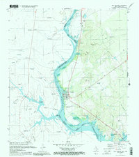
1979 Map of San Ygnacio
USGS Topo · Published 1980About this map
San Ygnacio and its cross-border counterpart San Ignacio stand as the primary settlements along the Rio Grande during the late 1970s. The landscape is dominated by the rising waters of the Falcon Reservoir, where several buoys mark the submerged international boundary. This era shows a transition in land use along the river, with older sites like Santa Cruz (Abandonado) giving way to modern infrastructure such as the Landing Strip and Roadside Park. Local genealogy is well-documented through several burial grounds, including the Uribe Cem, Cementerio Del Pueblo, and New Ramireño Cem. Away from the water, the terrain is defined by complex arroyos like Arroyo El Grullo Creek and Arroyo San Francisco, while smaller ranching outposts such as Rancho Grande (Tio Salinas) and El Rebombeo dot the Zapata County brushland.
Find a feature on this map
67 named features on this map. Tap any name to fly to it.
Don’t see what you’re looking for? This feature index may not catch every label — zoom into the map to look around manually.
Map Details
Editions of this 1979 San Ygnacio Map
2 editions found
Other maps of this area

1942 · San Ygnacio
USGS Topo · 1:62,500

1949 · Mc Allen
USGS Topo · 1:250,000

1954 · McAllen
USGS Topo · 1:250,000

1956 · Zapata
USGS Topo · 1:62,500

1956 · Laredo
USGS Topo · 1:250,000

1957 · Mc Allen
USGS Topo · 1:250,000

1962 · McAllen
USGS Topo · 1:250,000
1979 · Zapata
USGS Topo · 1:24,000
1979 · Zapata NW
USGS Topo · 1:24,000
1979 · San Ygnacio
USGS Topo · 1:24,000