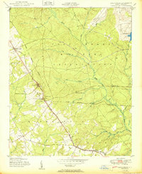
1950 Map of Sanatorium
USGS Topo · Published 1950About this map
The State Tuberculosis Sanatorium dominates the western landscape of this Hoke County survey, marking a significant era of public health infrastructure in North Carolina. This medical facility, situated near Sandstone Hill, is served by the Aberdeen and Rockfish railroad, which cuts diagonally across the terrain through local junctions like Pooles Siding and Montrose.
Find a feature on this map
33 named features on this map. Tap any name to fly to it.
Don’t see what you’re looking for? This feature index may not catch every label — zoom into the map to look around manually.
Map Details
Editions of this 1950 Sanatorium Map
2 editions found
Other maps of this area

1948 · Southern Pines
USGS Topo · 1:62,500

1948 · Clifdale
USGS Topo · 1:62,500

1948 · Pinebluff
USGS Topo · 1:24,000

1948 · Nicholson Creek
USGS Topo · 1:24,000

1948 · Mc Cain
USGS Topo · 1:24,000

1949 · Wagram
USGS Topo · 1:24,000

1949 · Silver Hill
USGS Topo · 1:24,000

1949 · Laurinburg
USGS Topo · 1:62,500

1950 · Sanatorium
USGS Topo · 1:24,000

1950 · Lobelia
USGS Topo · 1:24,000