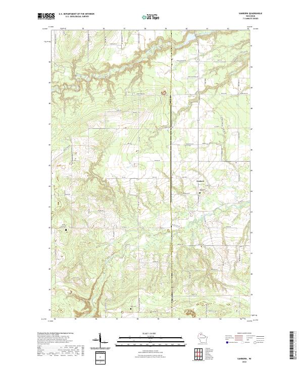
2022 Map of Sanborn
USGS Topo · Published 2022About this map
The settlement of Sanborn serves as the focal point of this northern Wisconsin landscape, situated near the intersection of Argo Rd and Osedkar Rd. Religious life and local history are anchored by Saint Anne Catholic Cem and the Moland Lutheran Church to the southwest. The terrain is defined by a dense network of waterways, including the winding White River in the north and the Marengo River flowing through the southern portion of the quadrangle. A system of rural roads, many bearing family names like Franciskovich Rd, Puskarich Rd, and Vernon Johnson Rd, suggests a long history of local land ownership and agricultural settlement. The boundary between Bayfield and Ashland counties runs vertically through the center, marking a significant administrative divide in this forested and river-carved region.
Find a feature on this map
76 named features on this map. Tap any name to fly to it.
Don’t see what you’re looking for? This feature index may not catch every label — zoom into the map to look around manually.
Map Details
Editions of this 2022 Sanborn Map
This is the sole edition of this map. No revisions or reprints were ever made.
Other maps of this area

1942 · Ashland
USGS Topo · 1:48,000

1942 · Marengo
USGS Topo · 1:48,000

1944 · Moquah
USGS Topo · 1:48,000

1944 · Grandview
USGS Topo · 1:48,000

1945 · Marengo
USGS Topo · 1:48,000

1947 · Moquah
USGS Topo · 1:48,000

1947 · Ashland
USGS Topo · 1:48,000

1947 · Grandview
USGS Topo · 1:48,000

1953 · Ashland
USGS Topo · 1:250,000

1958 · Ashland
USGS Topo · 1:250,000