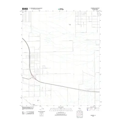
2012 Map of Sanborn
USGS Topo · Published 2012About this map
Sanborn sits at the southern edge of this Mojave Desert landscape, characterized by an extensive grid of planned roads extending into the Fremont Valley. The settlement pattern reflects the mid-century ambitions of California City, where vast tracts were surveyed and named long before dense residential development arrived. Major thoroughfares like Mojave Blvd and E Bishop Dr provide structure to the grid, while the intermittent path of Cache Cr cuts across the northern terrain. The topography is anchored by Sanborn Hill in the southwest, rising above a network of alphabetically and geographically named streets such as Altus Ave and Decatur Ave. This map records a landscape in a state of suspended anticipation, where the infrastructure of a future city meets the dry washes of the desert.
Find a feature on this map
48 named features on this map. Tap any name to fly to it.
Don’t see what you’re looking for? This feature index may not catch every label — zoom into the map to look around manually.
Map Details
Editions of this 2012 Sanborn Map
This is the sole edition of this map. No revisions or reprints were ever made.
Other maps of this area

1915 · Elizabeth Lake
USGS Topo · 1:125,000

1915 · Searles Lake
USGS Topo · 1:250,000

1915 · Mojave
USGS Topo · 1:125,000

1917 · Elizabeth Lake
USGS Topo · 1:125,000

1937 · Rogers Lake
USGS Topo · 1:48,000

1942 · Rogers Lake
USGS Topo · 1:62,500

1943 · Rosamond
USGS Topo · 1:62,500

1943 · Castle Butte
USGS Topo · 1:62,500

1943 · Mojave
USGS Topo · 1:62,500

1947 · Fluhr
USGS Topo · 1:24,000