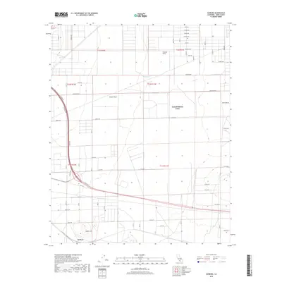
2018 Map of Sanborn
USGS Topo · Published 2018About this map
California City occupies the central and eastern portions of this High Desert landscape, showing the planned grid of one of the largest land developments in the state. The town's ambitious layout is defined by long, straight thoroughfares like Arroyo Ave and Rosewood Blvd that stretch across the Mojave Desert. To the southwest, the small settlement of Sanborn is located near the base of Sanborn Hill, representing a more concentrated pocket of development compared to the vast open sections of the northern Fremont Valley.
Find a feature on this map
61 named features on this map. Tap any name to fly to it.
Don’t see what you’re looking for? This feature index may not catch every label — zoom into the map to look around manually.
Map Details
Editions of this 2018 Sanborn Map
This is the sole edition of this map. No revisions or reprints were ever made.
Other maps of this area

1915 · Elizabeth Lake
USGS Topo · 1:125,000

1915 · Searles Lake
USGS Topo · 1:250,000

1915 · Mojave
USGS Topo · 1:125,000

1917 · Elizabeth Lake
USGS Topo · 1:125,000

1937 · Rogers Lake
USGS Topo · 1:48,000

1942 · Rogers Lake
USGS Topo · 1:62,500

1943 · Rosamond
USGS Topo · 1:62,500

1943 · Castle Butte
USGS Topo · 1:62,500

1943 · Mojave
USGS Topo · 1:62,500

1947 · Fluhr
USGS Topo · 1:24,000