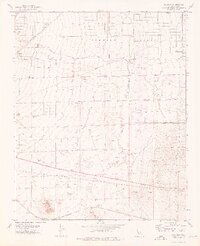
1973 Map of Sanborn
USGS Topo · Published 1976About this map
Fremont Valley dominates this 1970s landscape, revealing the intersection of industrial infrastructure and nascent desert development. To the east, the City Corporate Boundary of California City marks the edge of a planned community, while the vast arid floor is crisscrossed by multiple pipelines and essential water infrastructure, including several observation wells and dry wells. The terrain is anchored by Sanborn Hill in the southwest, rising near the junction of major transportation corridors.
Find a feature on this map
22 named features on this map. Tap any name to fly to it.
Don’t see what you’re looking for? This feature index may not catch every label — zoom into the map to look around manually.
Map Details
Editions of this 1973 Sanborn Map
3 editions found
Other maps of this area

1915 · Elizabeth Lake
USGS Topo · 1:125,000

1915 · Searles Lake
USGS Topo · 1:250,000

1915 · Mojave
USGS Topo · 1:125,000

1917 · Elizabeth Lake
USGS Topo · 1:125,000

1937 · Rogers Lake
USGS Topo · 1:48,000

1942 · Rogers Lake
USGS Topo · 1:62,500

1943 · Rosamond
USGS Topo · 1:62,500

1943 · Castle Butte
USGS Topo · 1:62,500

1943 · Mojave
USGS Topo · 1:62,500

1947 · Fluhr
USGS Topo · 1:24,000