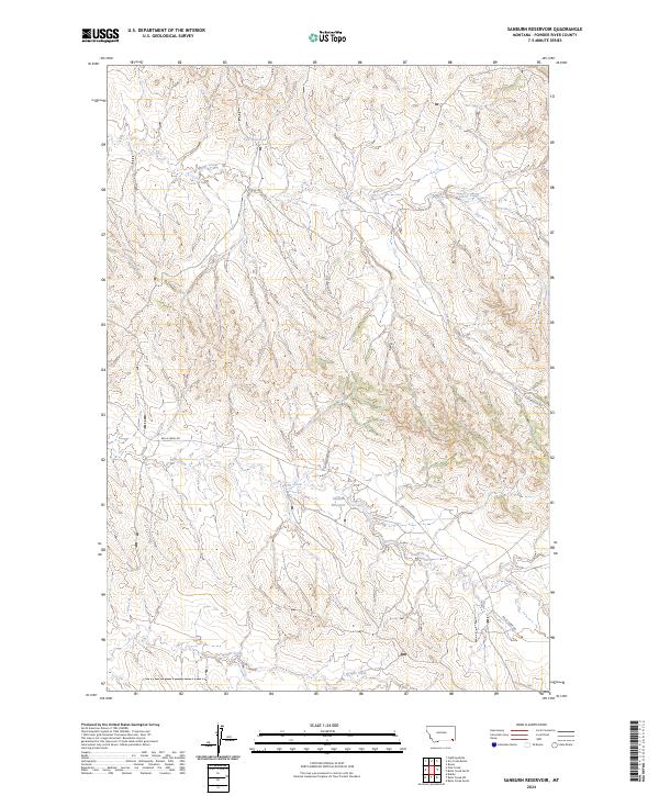
2024 Map of Sanburn Reservoir
USGS Topo · Published 2024About this map
Sanburn Reservoir and the drainage basin of Belle Creek define this section of Powder River County, where water management is central to the landscape. This contemporary survey by the U.S. Geological Survey illustrates the importance of localized water storage in an arid region, evidenced by the presence of CCC Reservoir in the northern reaches and Sanburn Reservoir further south. These features, along with Horse Creek and Wright Creek, serve as critical landmarks for land management and navigation across the broken terrain. The infrastructure is minimal, consisting primarily of rural routes like Belle Creek Rd and Gotfredson Rd, which provide access to the remote township sections of the t7s r53e and t8s r53e boundaries. This map offers a clear view of how modern resource management and ranching roads continue to follow the natural contours of the Montana high plains.
Find a feature on this map
11 named features on this map. Tap any name to fly to it.
Don’t see what you’re looking for? This feature index may not catch every label — zoom into the map to look around manually.
Map Details
Editions of this 2024 Sanburn Reservoir Map
This is the sole edition of this map. No revisions or reprints were ever made.
Other maps of this area

1954 · Ekalaka
USGS Topo · 1:250,000

1956 · Ekalaka
USGS Topo · 1:250,000

1958 · Ekalaka
USGS Topo · 1:250,000

1965 · Ekalaka
USGS Topo · 1:250,000

1970 · Pine Creek
USGS Topo · 1:24,000

1970 · Sanburn Reservoir
USGS Topo · 1:24,000
1970 · Belle Creek North
USGS Topo · 1:24,000
1970 · Belle Creek South
USGS Topo · 1:24,000

1970 · Belle Creek SW
USGS Topo · 1:24,000
1970 · Biddle
USGS Topo · 1:24,000