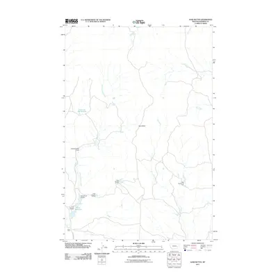
2011 Map of Sand Buttes
USGS Topo · Published 2011About this map
Barley Ranch anchor this landscape of the High Plains, where ranching and water management define the local geography. The area is marked by a series of engineered water features, including Hook Number 51 Dam, Hook Number 50 Dam, and others in the Hook series, illustrating the importance of irrigation and livestock watering in this arid portion of Rosebud County. Named coulees such as Fisherman Dan Coulee and Sand Butte Coulee cut through the terrain, draining toward significant watercourses like Coal Creek and the North Fork Sand Creek. The presence of Fisherman Dan Reservoir and the Barley Reservoirs further emphasizes the reliance on man-made storage. The single primary thoroughfare, Sand Creek Rd, provides the essential link across these drainage basins and between the eponymous Sand Buttes.
Find a feature on this map
14 named features on this map. Tap any name to fly to it.
Don’t see what you’re looking for? This feature index may not catch every label — zoom into the map to look around manually.
Map Details
Editions of this 2011 Sand Buttes Map
This is the sole edition of this map. No revisions or reprints were ever made.
Other maps of this area

1954 · Forsyth
USGS Topo · 1:250,000

1957 · Forsyth
USGS Topo · 1:250,000

1958 · Forsyth
USGS Topo · 1:250,000

1968 · Rosebud
USGS Topo · 1:24,000

1968 · Box Canyon Coulee
USGS Topo · 1:24,000

1968 · Sand Buttes
USGS Topo · 1:24,000

1968 · Hathaway
USGS Topo · 1:24,000

1968 · Hathaway NW
USGS Topo · 1:24,000

1968 · Thurlow
USGS Topo · 1:24,000

1969 · Wild Horse Pass SE
USGS Topo · 1:24,000