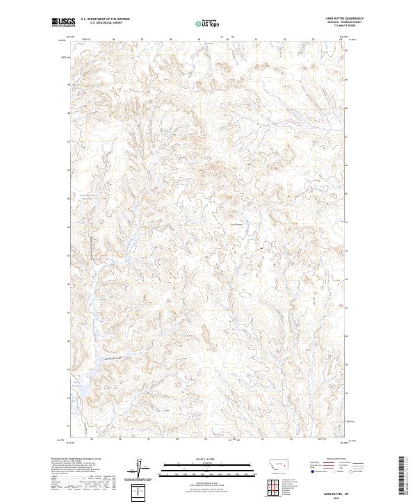
2024 Map of Sand Buttes
USGS Topo · Published 2024About this map
Sand Buttes rise as a central landmark in this portion of Rosebud County, where the high plains landscape is deeply incised by a network of drainage coulees. Water management is a primary feature of the local geography, visible through the presence of Fisherman Dan Reservoir and Barley Reservoirs, which serve as vital catchments in an arid environment. The map details a complex system of seasonal waterways, including Coal Creek, Bull Creek, and the long winding paths of Fisherman Dan Coulee and Sand Butte Coulee. Access through this remote terrain is largely restricted to improved tracks such as Sand Creek Rd, which follows the southern drainage of Sand Creek. The township and range lines of T8N R43E and T9N R43E reveal a landscape divided by large-scale ranching or public land management, where the survival of cattle and wildlife depends on these scattered water improvements.
Find a feature on this map
16 named features on this map. Tap any name to fly to it.
Don’t see what you’re looking for? This feature index may not catch every label — zoom into the map to look around manually.
Map Details
Editions of this 2024 Sand Buttes Map
This is the sole edition of this map. No revisions or reprints were ever made.
Other maps of this area

1954 · Forsyth
USGS Topo · 1:250,000

1957 · Forsyth
USGS Topo · 1:250,000

1958 · Forsyth
USGS Topo · 1:250,000

1968 · Rosebud
USGS Topo · 1:24,000

1968 · Box Canyon Coulee
USGS Topo · 1:24,000

1968 · Sand Buttes
USGS Topo · 1:24,000

1968 · Hathaway
USGS Topo · 1:24,000

1968 · Hathaway NW
USGS Topo · 1:24,000

1968 · Thurlow
USGS Topo · 1:24,000

1969 · Wild Horse Pass SE
USGS Topo · 1:24,000