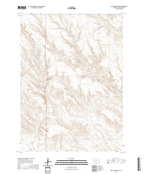
2021 Map of Sand Canyon West
USGS Topo · Published 2021About this map
Steffensen Reservoir provides a focal point for water management in this high plains region of Dawes County, Nebraska. The landscape is defined by the drainage patterns of Pepper Cr and the topographical impression of Sand Canyon, which cuts through the northeastern portion of the sheet. This area is characterized by a sparse, grid-like network of rural roads that facilitate movement across the ranchlands, including Old Dunlap Rd and Prairie Home Rd. The survey illustrates the intersection of modern land use with the established Public Land Survey System, showing several townships such as t30n r48w. The presence of named routes like Marchant Rd and Autogate Rd indicates the localized infrastructure necessary for navigating the open terrain of the Nebraska Panhandle.
Find a feature on this map
15 named features on this map. Tap any name to fly to it.
Don’t see what you’re looking for? This feature index may not catch every label — zoom into the map to look around manually.
Map Details
Editions of this 2021 Sand Canyon West Map
This is the sole edition of this map. No revisions or reprints were ever made.
Other maps of this area

1947 · Box Butte NE
USGS Topo · 1:24,000

1947 · Box Butte NW
USGS Topo · 1:24,000

1948 · Box Butte Reservoir East
USGS Topo · 1:24,000

1949 · Box Butte NE
USGS Topo · 1:24,000

1949 · Box Butte NW
USGS Topo · 1:24,000

1955 · Alliance
USGS Topo · 1:250,000

1957 · Alliance
USGS Topo · 1:250,000

1958 · Alliance
USGS Topo · 1:250,000

1966 · Chadron 3 SE
USGS Topo · 1:24,000

1966 · Chadron 3 NE
USGS Topo · 1:24,000