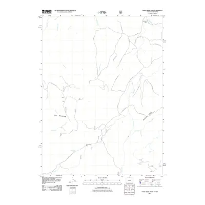
2011 Map of Sand Creek Pass
USGS Topo · Published 2011About this map
Sand Creek Pass serves as a focal point for this high-elevation landscape along the border of Colorado and Wyoming, where the terrain is defined by prominent features like Bull Mountain and the expansive Boulder Ridge. The drainage patterns are clearly delineated, with Shell Creek, Bull Run Creek, and Sand Creek carving through the topography. In addition to natural landmarks such as Chimney Rock and Mushroom Rock, the map reveals the infrastructure of the early 21st century, including the Wilson Ditch and a network of named routes like Camel Rock Rd and Ferret Cir. For those interested in water sources and hydrology, the presence of Jimmy Creek Spring and numerous small tributaries provides an intimate look at the headwaters that define this rural region.
Find a feature on this map
44 named features on this map. Tap any name to fly to it.
Don’t see what you’re looking for? This feature index may not catch every label — zoom into the map to look around manually.
Map Details
Editions of this 2011 Sand Creek Pass Map
This is the sole edition of this map. No revisions or reprints were ever made.
Other maps of this area

1895 · Laramie
USGS Topo · 1:125,000

1902 · Laramie
USGS Topo · 1:125,000

1905 · Laramie
USGS Topo · 1:125,000

1906 · Laramie
USGS Topo · 1:125,000

1908 · Laramie
USGS Topo · 1:125,000

1916 · Home
USGS Topo · 1:125,000

1920 · Home
USGS Topo · 1:125,000

1954 · Cheyenne
USGS Topo · 1:250,000

1954 · Greeley
USGS Topo · 1:250,000

1957 · Greeley
USGS Topo · 1:250,000