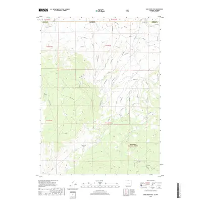
2019 Map of Sand Creek Pass
USGS Topo · Published 2019About this map
Bull Mtn anchors the high country of this Larimer County landscape, where the border between Colorado and Wyoming cuts across high-elevation plateaus and steep drainages. The map details a rugged transition zone within the Roosevelt National Forest, characterized by numerous ridges such as Honeymoon Ridge and Windy Ridge Rd. A singular piece of local history is recorded at the Roy Sweetland Grave, located near the western edge of the quadrangle. Water management and natural springs are vital features here, from the human-made Wilson Ditch to Jimmy Creek Spring. Geological formations like Chimney Rock and Mushroom Rock offer landmarks for navigators, while the Sand Creek Overlook provides a vantage point over the complex network of creeks, including E Shell Cr and Trollop Cr.
Find a feature on this map
66 named features on this map. Tap any name to fly to it.
Don’t see what you’re looking for? This feature index may not catch every label — zoom into the map to look around manually.
Map Details
Editions of this 2019 Sand Creek Pass Map
This is the sole edition of this map. No revisions or reprints were ever made.
Other maps of this area

1895 · Laramie
USGS Topo · 1:125,000

1902 · Laramie
USGS Topo · 1:125,000

1905 · Laramie
USGS Topo · 1:125,000

1906 · Laramie
USGS Topo · 1:125,000

1908 · Laramie
USGS Topo · 1:125,000

1916 · Home
USGS Topo · 1:125,000

1920 · Home
USGS Topo · 1:125,000

1954 · Cheyenne
USGS Topo · 1:250,000

1954 · Greeley
USGS Topo · 1:250,000

1957 · Greeley
USGS Topo · 1:250,000