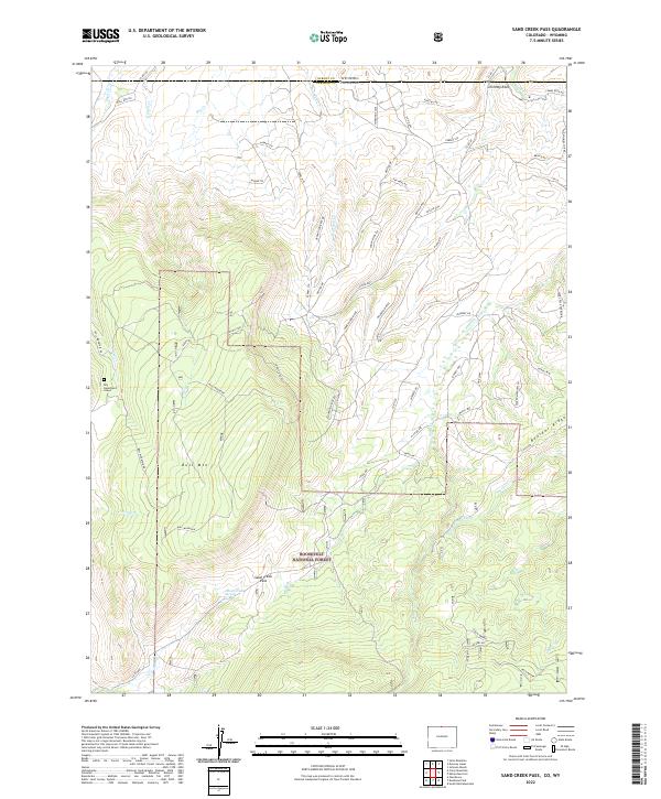
2022 Map of Sand Creek Pass
USGS Topo · Published 2022About this map
Roosevelt National Forest dominates this section of the high country along the border of Larimer County and Wyoming. The terrain is characterized by prominent peaks and ridges, most notably Bull Mtn and the adjacent Boulder Ridge. A poignant landmark, the Roy Sweetland Grave, sits in the western portion of the map, providing a rare human touchstone in a landscape largely defined by its natural topography. The network of drainage systems, including Dry Cr, Bull Run Cr, and Sheep Cr, illustrates the complex watershed feeding into Sand Cr. Evidence of land management and historical water rights can be found in the Wilson Ditch and the preservation of Jimmy Creek Spring. Distinctive rock formations such as Chimney Rock and Mushroom Rock serve as clear navigational markers across the Wyoming Flats.
Find a feature on this map
68 named features on this map. Tap any name to fly to it.
Don’t see what you’re looking for? This feature index may not catch every label — zoom into the map to look around manually.
Map Details
Editions of this 2022 Sand Creek Pass Map
This is the sole edition of this map. No revisions or reprints were ever made.
Other maps of this area

1895 · Laramie
USGS Topo · 1:125,000

1902 · Laramie
USGS Topo · 1:125,000

1905 · Laramie
USGS Topo · 1:125,000

1906 · Laramie
USGS Topo · 1:125,000

1908 · Laramie
USGS Topo · 1:125,000

1916 · Home
USGS Topo · 1:125,000

1920 · Home
USGS Topo · 1:125,000

1954 · Cheyenne
USGS Topo · 1:250,000

1954 · Greeley
USGS Topo · 1:250,000

1957 · Greeley
USGS Topo · 1:250,000