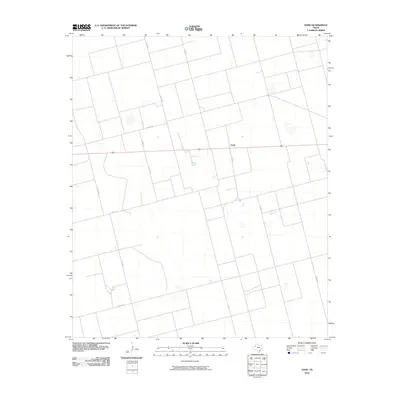
2010 Map of Sand
USGS Topo · Published 2010About this map
Sand serves as the focal point for this section of Dawson County, illustrating a vast agricultural landscape defined by a rigid grid of rural roads. This 2010 survey by the U.S. Geological Survey captures a sparsely populated region where life and commerce are dictated by the transportation network. The area is intersected by several county routes, including Co Rd 100 and Co Rd CC, which facilitate movement between scattered homesteads and fields. The land use patterns evident here, such as the parcels bounded by Co Rd 453 and Co Rd 422, highlight the systematic organization of the High Plains, where large-scale farming dominates the environment. This map provides a clear record of the rural infrastructure as it existed in the early 21st century.
Find a feature on this map
10 named features on this map. Tap any name to fly to it.
Don’t see what you’re looking for? This feature index may not catch every label — zoom into the map to look around manually.
Map Details
Editions of this 2010 Sand Map
This is the sole edition of this map. No revisions or reprints were ever made.
Other maps of this area

1954 · Hobbs
USGS Topo · 1:250,000

1958 · Hobbs
USGS Topo · 1:250,000

1969 · Welch SW
USGS Topo · 1:24,000

1969 · Punkin Center
USGS Topo · 1:24,000

1970 · Patricia SW
USGS Topo · 1:24,000

1970 · Patricia
USGS Topo · 1:24,000

1970 · McKenzie Lake SE
USGS Topo · 1:24,000

1970 · Sand
USGS Topo · 1:24,000

1970 · McKenzie Lake
USGS Topo · 1:24,000
1970 · Cedar Point
USGS Topo · 1:24,000