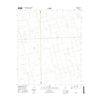
2016 Map of Sand
USGS Topo · Published 2016About this map
The community of Sand sits at the intersection of long-established West Texas ranch roads and the modern highway system, serving as a primary point of reference in this expansive landscape. This 2016 survey illustrates a terrain defined by the McKenzie Draw, a prominent ephemeral watercourse that cuts diagonally across the topography. The map detail highlights the exact boundary between Dawson Co and Gaines Co, a line that divides the vast agricultural and ranching tracts. The network of county roads, such as Co Rd 100 and Co Rd CC, provides a clear view of the rural infrastructure that has supported this region's development. These survey lines and drainage patterns offer specific data for those studying the physical history and land use of the South Plains area.
Find a feature on this map
14 named features on this map. Tap any name to fly to it.
Don’t see what you’re looking for? This feature index may not catch every label — zoom into the map to look around manually.
Map Details
Editions of this 2016 Sand Map
This is the sole edition of this map. No revisions or reprints were ever made.
Other maps of this area

1954 · Hobbs
USGS Topo · 1:250,000

1958 · Hobbs
USGS Topo · 1:250,000

1969 · Welch SW
USGS Topo · 1:24,000

1969 · Punkin Center
USGS Topo · 1:24,000

1970 · Patricia SW
USGS Topo · 1:24,000

1970 · Patricia
USGS Topo · 1:24,000

1970 · McKenzie Lake SE
USGS Topo · 1:24,000

1970 · Sand
USGS Topo · 1:24,000

1970 · McKenzie Lake
USGS Topo · 1:24,000
1970 · Cedar Point
USGS Topo · 1:24,000