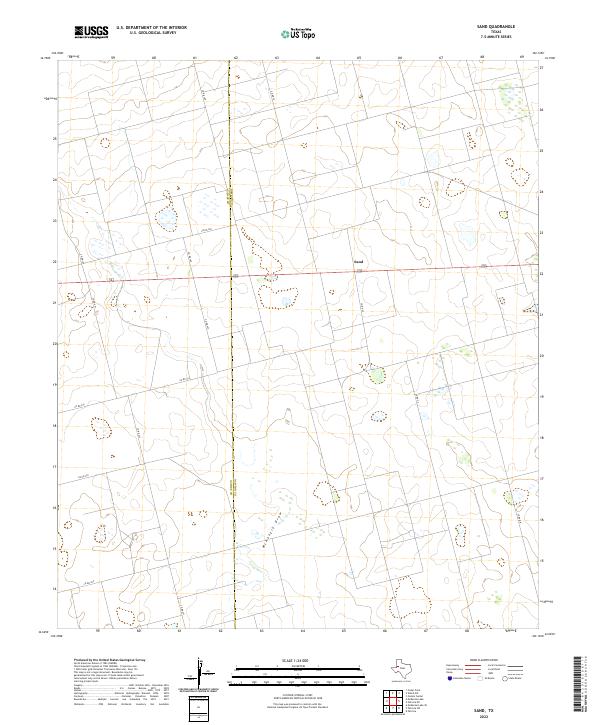
2022 Map of Sand
USGS Topo · Published 2022About this map
The settlement of Sand anchors this high plains landscape at the intersection of local county roads and Highway 180. Located along the border of Gaines Co and Dawson Co, the area is defined by its agricultural character and the subtle topographic relief of the West Texas Llano Estacado. The terrain is notably marked by McKenzie Draw, a drainage feature that meanders through the arid landscape, influencing the placement of field boundaries and the local road network.
Find a feature on this map
15 named features on this map. Tap any name to fly to it.
Don’t see what you’re looking for? This feature index may not catch every label — zoom into the map to look around manually.
Map Details
Editions of this 2022 Sand Map
This is the sole edition of this map. No revisions or reprints were ever made.
Other maps of this area

1954 · Hobbs
USGS Topo · 1:250,000

1958 · Hobbs
USGS Topo · 1:250,000

1969 · Welch SW
USGS Topo · 1:24,000

1969 · Punkin Center
USGS Topo · 1:24,000

1970 · Patricia SW
USGS Topo · 1:24,000

1970 · Patricia
USGS Topo · 1:24,000

1970 · McKenzie Lake SE
USGS Topo · 1:24,000

1970 · Sand
USGS Topo · 1:24,000

1970 · McKenzie Lake
USGS Topo · 1:24,000
1970 · Cedar Point
USGS Topo · 1:24,000