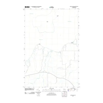
2010 Map of Sand Island
USGS Topo · Published 2010About this map
Sand Island and the neighboring shoreline of Lake Superior define this coastal portion of Bayfield County. The landscape is marked by the distinct protrusion of Swallow Point on the island and Sand Point on the mainland, creating a sheltered environment for Sand Bay. Drainage for the immediate interior is provided by the Sand River, which is joined by Rocket Creek before it reaches the lake, while the Raspberry River flows through the eastern portion of the quadrangle. The road network, including W Old County K Rd and Little Sand Bay Rd, suggests a landscape focused on access to the shoreline and the timbered reaches of northern Wisconsin. This 2010 survey provides a clear view of the hydrological and coastal features as they existed at the turn of the decade.
Find a feature on this map
19 named features on this map. Tap any name to fly to it.
Don’t see what you’re looking for? This feature index may not catch every label — zoom into the map to look around manually.
Map Details
Editions of this 2010 Sand Island Map
This is the sole edition of this map. No revisions or reprints were ever made.
Other maps of this area

1941 · Bayfield
USGS Topo · 1:48,000

1944 · Cornucopia
USGS Topo · 1:48,000

1946 · Cornucopia
USGS Topo · 1:48,000

1946 · Bayfield
USGS Topo · 1:48,000

1953 · Ashland
USGS Topo · 1:250,000

1954 · Two Harbors
USGS Topo · 1:250,000

1957 · Two Harbors
USGS Topo · 1:250,000

1958 · Ashland
USGS Topo · 1:250,000

1958 · Two Harbors
USGS Topo · 1:250,000
1963 · Bear Island
USGS Topo · 1:24,000