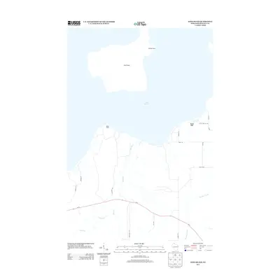
2013 Map of Sand Island
USGS Topo · Published 2013About this map
Sand Island sits in the cold waters of Lake Superior, serving as a focal point for this coastal survey of Bayfield County. The island, characterized by Swallow Point at its northern reaches, faces a rugged shoreline where the Sand River and Raspberry River meet the lake. On the mainland, a network of local roads like Scheffel Dr and Ridge Rd connects small settlements near Sand Bay to the primary arterial Wi-13. This landscape illustrates the quiet, rural character of northern Wisconsin, where the forest gives way to sand-bottomed bays and points. The drainage patterns of Racket Cr and other small tributaries show the intricate hydrology that feeds the great lake, documenting the area's geography before further modern development.
Find a feature on this map
22 named features on this map. Tap any name to fly to it.
Don’t see what you’re looking for? This feature index may not catch every label — zoom into the map to look around manually.
Map Details
Editions of this 2013 Sand Island Map
This is the sole edition of this map. No revisions or reprints were ever made.
Other maps of this area

1941 · Bayfield
USGS Topo · 1:48,000

1944 · Cornucopia
USGS Topo · 1:48,000

1946 · Cornucopia
USGS Topo · 1:48,000

1946 · Bayfield
USGS Topo · 1:48,000

1953 · Ashland
USGS Topo · 1:250,000

1954 · Two Harbors
USGS Topo · 1:250,000

1957 · Two Harbors
USGS Topo · 1:250,000

1958 · Ashland
USGS Topo · 1:250,000

1958 · Two Harbors
USGS Topo · 1:250,000
1963 · Bear Island
USGS Topo · 1:24,000