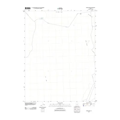
2011 Map of Sand Pass
USGS Topo · Published 2011About this map
Fish Springs Range dominates the northern horizon of this Millard County landscape, where the high desert terrain transitions into the wide expanse of Fish Springs Flat. The area is defined by its isolation and the vital presence of water management in a dry environment, notably marked by the Roadside Reservoir situated along the Weiss Hwy. This thoroughfare, along with the Sand Pass Rd, provides the primary means of navigating the gap at Sand Pass between the mountains. To the south and west, the map reveals the stark topography of Swasey Mountain and the floor of the Tule Valley. The sparse distribution of named features underscores the remote character of this Great Basin region, where human impact is primarily limited to essential transportation corridors and small-scale water catchment systems designed to support travel through the desert.
Find a feature on this map
8 named features on this map. Tap any name to fly to it.
Don’t see what you’re looking for? This feature index may not catch every label — zoom into the map to look around manually.
Map Details
Editions of this 2011 Sand Pass Map
This is the sole edition of this map. No revisions or reprints were ever made.
Other maps of this area

1908 · Fish Springs
USGS Topo · 1:250,000

1910 · Fish Springs
USGS Topo · 1:250,000

1953 · Delta
USGS Topo · 1:250,000

1958 · Delta
USGS Topo · 1:250,000

1959 · Cowboy Pass
USGS Topo · 1:62,500

1960 · Granite Mountain
USGS Topo · 1:62,500

1962 · Delta
USGS Topo · 1:250,000

1967 · Sand Pass
USGS Topo · 1:24,000

1967 · Sand Pass NW
USGS Topo · 1:24,000

1967 · Sand Pass SE
USGS Topo · 1:24,000