
1967 Map of Sand Pass SE
USGS Topo · Published 1970About this map
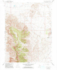
Swasey Mountain dominates this high-desert landscape in the late 1960s, its steep ridges and elevations defining the western boundary between Juab and Millard counties. This arid terrain is marked by essential water infrastructure, including Swasey Point Res and Table Knoll Res, which underscore the region's reliance on managed water sources for survival and land use. The topography transitions from the vertical relief of the mountain range to the expansive Fish Springs Flat in the northwest, where a solitary Well is noted near the 4600-foot contour. The surveyor's placement of unimproved dirt tracks connecting these remote points suggests a landscape primarily utilized for grazing or early mineral exploration, with named landmarks like Swasey Point and Table Knoll serving as primary navigational anchors in the Great Basin wilderness.
Find a feature on this map
8 named features on this map. Tap any name to fly to it.
Don’t see what you’re looking for? This feature index may not catch every label — zoom into the map to look around manually.
Map Details
Editions of this 1967 Sand Pass SE Map
2 editions found
Other maps of this area

1908 · Fish Springs
USGS Topo · 1:250,000

1910 · Fish Springs
USGS Topo · 1:250,000

1953 · Topaz Mtn
USGS Topo · 1:62,500

1953 · Delta
USGS Topo · 1:250,000

1958 · Delta
USGS Topo · 1:250,000

1962 · Delta
USGS Topo · 1:250,000

1967 · Sand Pass
USGS Topo · 1:24,000

1967 · Sand Pass NW
USGS Topo · 1:24,000
1967 · Sand Pass NE
USGS Topo · 1:24,000
1972 · Swasey Peak
USGS Topo · 1:24,000