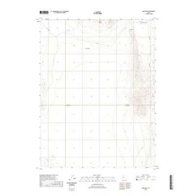
2020 Map of Sand Pass
USGS Topo · Published 2020About this map
The Fish Springs Range dominates the eastern edge of this landscape, its steep contours descending sharply toward the expansive Tule Valley and Fish Springs Flat. This Great Basin terrain is characterized by its isolation and dramatic elevation changes, where the historic Weis Hwy and Sand Pass Rd provide the primary corridors for travel through the desert floor. The map highlights the rugged topography around Sand Pass, a critical geographic waypoint between the northern and southern reaches of the range. Though water is scarce, the inclusion of Roadside Reservoir indicates the human effort to manage resources in this arid environment. The horizontal division between Juab Co and Millard Co marks a significant administrative boundary that cuts across the basin floor, providing a key reference point for researchers tracking land use and geopolitical boundaries in western Utah.
Find a feature on this map
8 named features on this map. Tap any name to fly to it.
Don’t see what you’re looking for? This feature index may not catch every label — zoom into the map to look around manually.
Map Details
Editions of this 2020 Sand Pass Map
This is the sole edition of this map. No revisions or reprints were ever made.
Other maps of this area

1908 · Fish Springs
USGS Topo · 1:250,000

1910 · Fish Springs
USGS Topo · 1:250,000

1953 · Delta
USGS Topo · 1:250,000

1958 · Delta
USGS Topo · 1:250,000

1959 · Cowboy Pass
USGS Topo · 1:62,500

1960 · Granite Mountain
USGS Topo · 1:62,500

1962 · Delta
USGS Topo · 1:250,000

1967 · Sand Pass
USGS Topo · 1:24,000

1967 · Sand Pass NW
USGS Topo · 1:24,000

1967 · Sand Pass SE
USGS Topo · 1:24,000