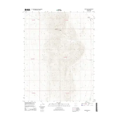
2014 Map of Sand Pass NW
USGS Topo · Published 2014About this map
George H Hansen Peak anchors the high ground of the Fish Springs Range, a prominent desert uplift that dominates this terrain in Juab County. The landscape is defined by the sharp transition from the steep, canyon-cut slopes of the range, including Sw Fish Cyn, to the low-lying expanse of the Fish Springs Flat to the northeast. This 2014 survey captures a sparsely populated region of the Great Basin where transportation follows the contours of the geology.
Find a feature on this map
13 named features on this map. Tap any name to fly to it.
Don’t see what you’re looking for? This feature index may not catch every label — zoom into the map to look around manually.
Map Details
Editions of this 2014 Sand Pass NW Map
This is the sole edition of this map. No revisions or reprints were ever made.
Other maps of this area

1908 · Fish Springs
USGS Topo · 1:250,000

1910 · Fish Springs
USGS Topo · 1:250,000

1953 · Delta
USGS Topo · 1:250,000

1958 · Delta
USGS Topo · 1:250,000

1960 · Granite Mountain
USGS Topo · 1:62,500

1962 · Delta
USGS Topo · 1:250,000

1967 · Sand Pass
USGS Topo · 1:24,000

1967 · Sand Pass NW
USGS Topo · 1:24,000

1967 · Sand Pass SE
USGS Topo · 1:24,000

1967 · Fish Springs SE
USGS Topo · 1:24,000