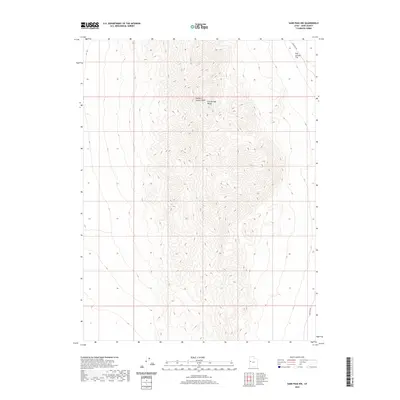
2020 Map of Sand Pass NW
USGS Topo · Published 2020About this map
George H. Hansen Peak dominates the center of this terrain-heavy survey, marking a high point within the Fish Springs Range of Juab County. The landscape is defined by steep, complex contouring that descends toward the northeast into Fish Springs Flat. This area represents a stark, arid corridor of the Great Basin, where the topography shifts abruptly from the sharp ridges of the mountains to the expansive, level desert basin. Human presence is minimal on this portion of the range, with Sand Pass Rd skirting the northeastern corner of the sheet and another segment of it appearing at the southeastern margin. The lack of settlements or structures highlights the high-desert character of the terrain, making this a focused study of elevation and geological form within this remote Utah range.
Find a feature on this map
4 named features on this map. Tap any name to fly to it.
Don’t see what you’re looking for? This feature index may not catch every label — zoom into the map to look around manually.
Map Details
Editions of this 2020 Sand Pass NW Map
This is the sole edition of this map. No revisions or reprints were ever made.
Other maps of this area

1908 · Fish Springs
USGS Topo · 1:250,000

1910 · Fish Springs
USGS Topo · 1:250,000

1953 · Delta
USGS Topo · 1:250,000

1958 · Delta
USGS Topo · 1:250,000

1960 · Granite Mountain
USGS Topo · 1:62,500

1962 · Delta
USGS Topo · 1:250,000

1967 · Sand Pass
USGS Topo · 1:24,000

1967 · Sand Pass NW
USGS Topo · 1:24,000

1967 · Sand Pass SE
USGS Topo · 1:24,000

1967 · Fish Springs SE
USGS Topo · 1:24,000