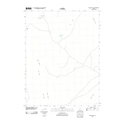
2011 Map of Sand Pass SE
USGS Topo · Published 2011About this map
Swasey Mountain dominates the western portion of this arid Millard County landscape, forming a prominent part of the House Range that runs north-to-south. The terrain is defined by its catchment and drainage systems, where isolated water sources like Swasey Point Reservoir and Table Knoll Reservoir serve the surrounding Fish Springs Flat. These small, man-made reservoirs indicate the necessity of water management in an area where ephemeral flows like Fish Springs Wash provide the primary natural drainage toward Swasey Bottom. The network of local roads and 4WD tracks suggests a region utilized for ranching or resource access rather than dense settlement, offering a clear look at the topographic relief between high summits like Swasey Point and the vast, low-lying basins.
Find a feature on this map
9 named features on this map. Tap any name to fly to it.
Don’t see what you’re looking for? This feature index may not catch every label — zoom into the map to look around manually.
Map Details
Editions of this 2011 Sand Pass SE Map
This is the sole edition of this map. No revisions or reprints were ever made.
Other maps of this area

1908 · Fish Springs
USGS Topo · 1:250,000

1910 · Fish Springs
USGS Topo · 1:250,000

1953 · Topaz Mtn
USGS Topo · 1:62,500

1953 · Delta
USGS Topo · 1:250,000

1958 · Delta
USGS Topo · 1:250,000

1962 · Delta
USGS Topo · 1:250,000

1967 · Sand Pass
USGS Topo · 1:24,000

1967 · Sand Pass NW
USGS Topo · 1:24,000

1967 · Sand Pass SE
USGS Topo · 1:24,000
1967 · Sand Pass NE
USGS Topo · 1:24,000