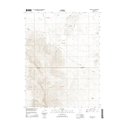
2014 Map of Sand Pass SE
USGS Topo · Published 2014About this map
Fish Springs Flat dominates the northern reaches of this Millard County landscape, where the terrain transitions from the open expanse of the flats into the complex ridges and canyons of the Swasey Point area. This 2014 survey illustrates a remote section of the Great Basin, where water management is critical to the local geography. Human impact is most visible through the presence of the Swasey Point Reservoir and Table Knoll Reservoir, essential catchments in an otherwise arid environment. The map details the dividing line between Juab and Millard counties, showing how the administrative boundary cuts across the high country near Dome Canyon. Transport through this rugged interior relies on a network of unpaved routes, including Swasey Rd and Table Knoll Rd, which provide access to landmarks like Table Knoll and the low-lying Swasey Bottom.
Find a feature on this map
16 named features on this map. Tap any name to fly to it.
Don’t see what you’re looking for? This feature index may not catch every label — zoom into the map to look around manually.
Map Details
Editions of this 2014 Sand Pass SE Map
This is the sole edition of this map. No revisions or reprints were ever made.
Other maps of this area

1908 · Fish Springs
USGS Topo · 1:250,000

1910 · Fish Springs
USGS Topo · 1:250,000

1953 · Topaz Mtn
USGS Topo · 1:62,500

1953 · Delta
USGS Topo · 1:250,000

1958 · Delta
USGS Topo · 1:250,000

1962 · Delta
USGS Topo · 1:250,000

1967 · Sand Pass
USGS Topo · 1:24,000

1967 · Sand Pass NW
USGS Topo · 1:24,000

1967 · Sand Pass SE
USGS Topo · 1:24,000
1967 · Sand Pass NE
USGS Topo · 1:24,000