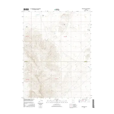
2017 Map of Sand Pass SE
USGS Topo · Published 2017About this map
Fish Springs Flat dominates the northern reaches of this high-desert landscape, where the administrative boundary of Juab Co and Millard Co bisects a terrain of alluvial washes and isolated peaks. This 2017 survey shows a region defined by its sparse water resources, centered on the Swasey Point Reservoir and Table Knoll Reservoir. These small catchments are critical landmarks in an arid basin where Fish Springs Wash and Dome Canyon provide the primary drainage for the surrounding uplands. Local transit is limited to unpaved connectors like Swasey Road and Springs Rd, which navigate the elevation changes between Swasey Point and Table Knoll. The map reveals the intricate topography of a remote Utah interior before modern development, preserving the alignment of section lines and range coordinates across the House Range region.
Find a feature on this map
14 named features on this map. Tap any name to fly to it.
Don’t see what you’re looking for? This feature index may not catch every label — zoom into the map to look around manually.
Map Details
Editions of this 2017 Sand Pass SE Map
This is the sole edition of this map. No revisions or reprints were ever made.
Other maps of this area

1908 · Fish Springs
USGS Topo · 1:250,000

1910 · Fish Springs
USGS Topo · 1:250,000

1953 · Topaz Mtn
USGS Topo · 1:62,500

1953 · Delta
USGS Topo · 1:250,000

1958 · Delta
USGS Topo · 1:250,000

1962 · Delta
USGS Topo · 1:250,000

1967 · Sand Pass
USGS Topo · 1:24,000

1967 · Sand Pass NW
USGS Topo · 1:24,000

1967 · Sand Pass SE
USGS Topo · 1:24,000
1967 · Sand Pass NE
USGS Topo · 1:24,000