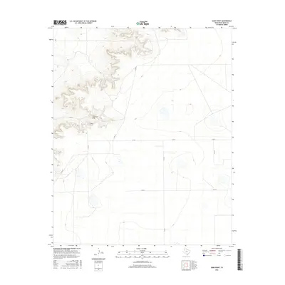
2016 Map of Sand Point
USGS Topo · Published 2016About this map
Sand Point stands as a prominent topographical landmark in the western reaches of Deaf Smith County, where the Llano Estacado begins its descent into the broken country of the Canadian River breaks. This modern 2016 survey by the U.S. Geological Survey illustrates a landscape defined by dramatic elevation changes, with the ephemeral Sand Point Draw carving a course through the high plains. The area is marked by a sparse network of section-line roads, including Co Rd 21 and Co Rd 24, which provide access to this isolated ranching territory. This map is particularly useful for understanding contemporary land use and water drainage patterns in the Texas Panhandle, showing how modern infrastructure like Co Rd Uu navigates the distinct local relief.
Find a feature on this map
9 named features on this map. Tap any name to fly to it.
Don’t see what you’re looking for? This feature index may not catch every label — zoom into the map to look around manually.
Map Details
Editions of this 2016 Sand Point Map
This is the sole edition of this map. No revisions or reprints were ever made.
Other maps of this area

1954 · Tucumcari
USGS Topo · 1:250,000

1954 · Clovis
USGS Topo · 1:250,000

1958 · Clovis
USGS Topo · 1:250,000

1958 · Tucumcari
USGS Topo · 1:250,000

1966 · Moser Ranch
USGS Topo · 1:24,000

1966 · Boise
USGS Topo · 1:24,000

1966 · Sand Point
USGS Topo · 1:24,000

1966 · Norton Lake
USGS Topo · 1:24,000

1968 · Rock Camp
USGS Topo · 1:24,000

1968 · Glenrio
USGS Topo · 1:24,000