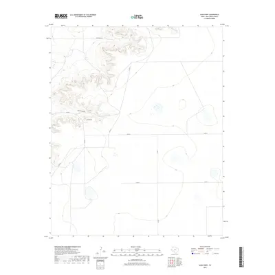
2019 Map of Sand Point
USGS Topo · Published 2019About this map
Sand Point stands as a prominent topographical landmark in this section of Deaf Smith County, marking a high point in a landscape defined by dramatic shifts in elevation. The terrain is deeply etched by drainage patterns, most notably the winding course of Sand Point Draw and the headwaters of Mujeres Cr in the northern reaches. This 2019 survey captures the highly organized, late-twentieth-century road grid that segments the High Plains, where routes like Co Rd UU and Co Rd 19 intersect at precise right angles across the open country. The contrast between the rigid geometry of the county road system and the jagged, irregular contours of the draws reveals the ongoing relationship between human agricultural divisions and the natural erosion of the Llano Estacado. Apart from the named roads and watercourses, the area remains largely undeveloped, highlighting the region's character as open ranchland or managed agricultural territory.
Find a feature on this map
10 named features on this map. Tap any name to fly to it.
Don’t see what you’re looking for? This feature index may not catch every label — zoom into the map to look around manually.
Map Details
Editions of this 2019 Sand Point Map
This is the sole edition of this map. No revisions or reprints were ever made.
Other maps of this area

1954 · Tucumcari
USGS Topo · 1:250,000

1954 · Clovis
USGS Topo · 1:250,000

1958 · Clovis
USGS Topo · 1:250,000

1958 · Tucumcari
USGS Topo · 1:250,000

1966 · Moser Ranch
USGS Topo · 1:24,000

1966 · Boise
USGS Topo · 1:24,000

1966 · Sand Point
USGS Topo · 1:24,000

1966 · Norton Lake
USGS Topo · 1:24,000

1968 · Rock Camp
USGS Topo · 1:24,000

1968 · Glenrio
USGS Topo · 1:24,000