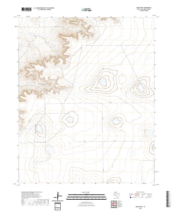
2022 Map of Sand Point
USGS Topo · Published 2022About this map
Sand Point serves as a prominent geographic landmark in this high-plains landscape of Deaf Smith County. The terrain is defined by the incision of Sand Point Draw, where the relief drops away from the surrounding flatlands into a series of complex contours and drainage patterns. This 2022 survey illustrates a sparse ranching environment where movement is dictated by a rigid grid of rural infrastructure, including Chuckwagon Rd and Co Rd 21. The map reveals the modern intersection of natural drainage and human organization, showing how county roads like Co Rd UU and Co Rd 19 navigate the subtle shifts in elevation across this corner of the Texas Panhandle.
Find a feature on this map
9 named features on this map. Tap any name to fly to it.
Don’t see what you’re looking for? This feature index may not catch every label — zoom into the map to look around manually.
Map Details
Editions of this 2022 Sand Point Map
This is the sole edition of this map. No revisions or reprints were ever made.
Other maps of this area

1954 · Tucumcari
USGS Topo · 1:250,000

1954 · Clovis
USGS Topo · 1:250,000

1958 · Clovis
USGS Topo · 1:250,000

1958 · Tucumcari
USGS Topo · 1:250,000

1966 · Moser Ranch
USGS Topo · 1:24,000

1966 · Boise
USGS Topo · 1:24,000

1966 · Sand Point
USGS Topo · 1:24,000

1966 · Norton Lake
USGS Topo · 1:24,000

1968 · Rock Camp
USGS Topo · 1:24,000

1968 · Glenrio
USGS Topo · 1:24,000