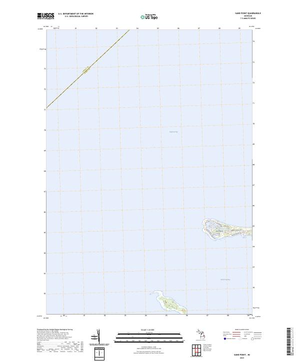
2023 Map of Sand Point
USGS Topo · Published 2023About this map
Sand Point extends into the waters of Lake Huron, dividing the expanse of Saginaw Bay from the sheltered reaches of Wild Fowl Bay. This modern survey illustrates the residential layout of this narrow peninsula, where a network of local roads including Crescent Beach Rd, Shore Dr, and Sunset Blvd trace the shoreline. The map also delineates the offshore boundaries between Arenac and Huron counties, illustrating how these administrative lines intersect the open water. The landscape is characterized by its low-lying coastal geography, with detailed bathymetric or marshland contours visible around the secondary landform situated south of the main point. This documentation provides a clear view of the contemporary shoreline and the developed residential character of this unique Michigan landform.
Find a feature on this map
12 named features on this map. Tap any name to fly to it.
Don’t see what you’re looking for? This feature index may not catch every label — zoom into the map to look around manually.
Map Details
Editions of this 2023 Sand Point Map
This is the sole edition of this map. No revisions or reprints were ever made.
Other maps of this area

1954 · Flint
USGS Topo · 1:250,000

1954 · Tawas City
USGS Topo · 1:250,000

1958 · Flint
USGS Topo · 1:250,000

1958 · Tawas City
USGS Topo · 1:250,000

1966 · Point Lookout
USGS Topo · 1:24,000

1970 · Bay Port West
USGS Topo · 1:24,000

1970 · Bay Port East
USGS Topo · 1:24,000

1970 · Caseville
USGS Topo · 1:24,000

1970 · Sand Point
USGS Topo · 1:24,000
1970 · Charity Island
USGS Topo · 1:24,000