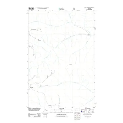
2011 Map of Sand Point
USGS Topo · Published 2011About this map
The high-altitude drainage systems of Central Montana define this landscape, where the waters of the North Fork Smith River and the North Fork Musselshell River originate near the Lost Fork Ridge. Mining operations are scattered throughout these mountains, including the Lenny Mine and the optimistically named Our Only Chance Mine on the slopes below Grendah Mountain. These small-scale extractive sites, often designated by legal land descriptions like the SE SE Section 21 Mine, suggest a history of prospecting in the rugged terrain between Coyote Peak and Sand Point. Local travel is anchored by the Jamison Trail Rd, which traverses a region of high parks and ranching outposts such as the Middle Fork Ranch and Ant Park. The map also traces the intricate headwaters of the West Fork Lost Fork and Cleveland Creek, showing how the hydrology of the Little Belt Mountains directs water toward different major river basins.
Find a feature on this map
24 named features on this map. Tap any name to fly to it.
Don’t see what you’re looking for? This feature index may not catch every label — zoom into the map to look around manually.
Map Details
Editions of this 2011 Sand Point Map
This is the sole edition of this map. No revisions or reprints were ever made.
Other maps of this area

1886 · Little Belt Mts.
USGS Topo · 1:250,000

1894 · Little Belt Mts.
USGS Topo · 1:250,000

1897 · Little Belt Mts.
USGS Topo · 1:250,000

1898 · Little Belt Mts.
USGS Topo · 1:250,000

1902 · Little Belt Mts.
USGS Topo · 1:250,000

1948 · White Sulphur Springs
USGS Topo · 1:250,000

1958 · White Sulphur Springs
USGS Topo · 1:250,000

1961 · White Sulphur Springs
USGS Topo · 1:250,000
1961 · Kings Hill
USGS Topo · 1:24,000
1961 · Neihart
USGS Topo · 1:24,000