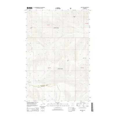
2014 Map of Sand Point
USGS Topo · Published 2014About this map
The Lewis & Clark National Forest dominates this mountain landscape, which serves as a significant drainage divide for several major Montana river systems. The southern portion of the map highlights the boundary between Judith Basin and Meagher Counties, where the Jamison-Trail Rd winds near high points like Lost Fork Ridge. This terrain is defined by its water sources, with the headwaters of the N-Fork Smith River and N-Fork Musselshell River flowing from these heights. Isolated mountain parks, including Spur Park and Ant Park, provide breaks in the wooded topography near Sand Point. The map also captures several distinct peaks and coulees, such as Grendah Mtn and Halzell Coulee, illustrating the complex network of ridges like Prospect Ridge that define the Little Belt Mountains' interior.
Find a feature on this map
26 named features on this map. Tap any name to fly to it.
Don’t see what you’re looking for? This feature index may not catch every label — zoom into the map to look around manually.
Map Details
Editions of this 2014 Sand Point Map
This is the sole edition of this map. No revisions or reprints were ever made.
Other maps of this area

1886 · Little Belt Mts.
USGS Topo · 1:250,000

1894 · Little Belt Mts.
USGS Topo · 1:250,000

1897 · Little Belt Mts.
USGS Topo · 1:250,000

1898 · Little Belt Mts.
USGS Topo · 1:250,000

1902 · Little Belt Mts.
USGS Topo · 1:250,000

1948 · White Sulphur Springs
USGS Topo · 1:250,000

1958 · White Sulphur Springs
USGS Topo · 1:250,000

1961 · White Sulphur Springs
USGS Topo · 1:250,000
1961 · Kings Hill
USGS Topo · 1:24,000
1961 · Neihart
USGS Topo · 1:24,000