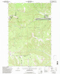
1995 Map of Sand Point
USGS Topo · Published 1997About this map
Grendah Mtn and the high ridges of the Lewis and Clark National Forest dominate this landscape along the border of Judith Basin Co and Meagher Co. The terrain is defined by a dense network of mountain drainages, where Cleveland Creek and Weatherwax Creek feed into the larger river systems. A clear economic shift from resource extraction to ranching is visible, as numerous Mines and Prospects dot the northern slopes while the Harrison Ranch occupies the more accessible valley land. The confluence of the West Fork Judith River and Lost Fork Judith River marks a primary hydrological junction at the foot of Lost Judith Fork Ridge. These watercourses provided the essential lifelines for early 20th-century homesteading and mining efforts in this part of Montana.
Find a feature on this map
28 named features on this map. Tap any name to fly to it.
Don’t see what you’re looking for? This feature index may not catch every label — zoom into the map to look around manually.
Map Details
Editions of this 1995 Sand Point Map
2 editions found
Other maps of this area

1886 · Little Belt Mts.
USGS Topo · 1:250,000

1894 · Little Belt Mts.
USGS Topo · 1:250,000

1897 · Little Belt Mts.
USGS Topo · 1:250,000

1898 · Little Belt Mts.
USGS Topo · 1:250,000

1902 · Little Belt Mts.
USGS Topo · 1:250,000

1948 · White Sulphur Springs
USGS Topo · 1:250,000

1958 · White Sulphur Springs
USGS Topo · 1:250,000

1961 · White Sulphur Springs
USGS Topo · 1:250,000
1961 · Kings Hill
USGS Topo · 1:24,000
1961 · Neihart
USGS Topo · 1:24,000