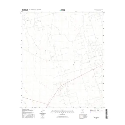
2016 Map of Sand Ranch
USGS Topo · Published 2016About this map
Sand Ranch anchors this portion of Andrews County, illustrating the isolated ranching landscape of West Texas. The area is defined by a sparse network of section-line roads and local thoroughfares, including S FM 181 and SW 900. A diagonal highway cuts across the southern portion of the quadrangle, serving as a primary transit vein through the open terrain. The mapping reflects the organized grid system typical of the Permian Basin region, where vast stretches of land are interconnected by designated routes such as SW 4990, SW 7401, and SW 7201. This 2016 survey captures the area's modern infrastructure, where established ranch names like Sand Ranch remain central landmarks in an otherwise open geographic layout.
Find a feature on this map
7 named features on this map. Tap any name to fly to it.
Don’t see what you’re looking for? This feature index may not catch every label — zoom into the map to look around manually.
Map Details
Editions of this 2016 Sand Ranch Map
This is the sole edition of this map. No revisions or reprints were ever made.
Other maps of this area

1954 · Hobbs
USGS Topo · 1:250,000

1958 · Hobbs
USGS Topo · 1:250,000

1968 · Coyote Corner
USGS Topo · 1:24,000

1968 · North Cowden NW
USGS Topo · 1:24,000

1971 · Figure Seven Ranch
USGS Topo · 1:24,000

1971 · Whalen Lake
USGS Topo · 1:24,000

1971 · Bedford Ranch
USGS Topo · 1:24,000

1971 · Frankel City SW
USGS Topo · 1:24,000

1971 · Sand Ranch
USGS Topo · 1:24,000
1971 · Y T Ranch
USGS Topo · 1:24,000