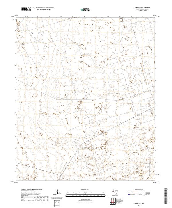
2022 Map of Sand Ranch
USGS Topo · Published 2022About this map
The arid Llano Estacado of Andrews County is defined here by a sparse network of ranch roads and section lines. This 2022 survey of the Sand Ranch area reveals a landscape primarily organized around resource extraction and cattle ranching, where modern infrastructure follows the rigid geometric grid typical of West Texas. The most prominent corridor is S Fm 181, which runs north-south through the eastern portion of the quadrangle. Radiating from this main artery are several secondary routes, including Sw 900 in the north and Sw 7401, which navigates the central terrain. The topographic data captures the subtle depressions and sandy draws that characterize this high plains environment, showing how later developments like Sw 4990 and Sw 7201 integrate into the existing ranchland patterns.
Find a feature on this map
6 named features on this map. Tap any name to fly to it.
Don’t see what you’re looking for? This feature index may not catch every label — zoom into the map to look around manually.
Map Details
Editions of this 2022 Sand Ranch Map
This is the sole edition of this map. No revisions or reprints were ever made.
Other maps of this area

1954 · Hobbs
USGS Topo · 1:250,000

1958 · Hobbs
USGS Topo · 1:250,000

1968 · Coyote Corner
USGS Topo · 1:24,000

1968 · North Cowden NW
USGS Topo · 1:24,000

1971 · Figure Seven Ranch
USGS Topo · 1:24,000

1971 · Whalen Lake
USGS Topo · 1:24,000

1971 · Bedford Ranch
USGS Topo · 1:24,000

1971 · Frankel City SW
USGS Topo · 1:24,000

1971 · Sand Ranch
USGS Topo · 1:24,000
1971 · Y T Ranch
USGS Topo · 1:24,000