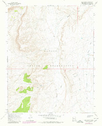
1966 Map of Sand Spring
USGS Topo · Published 1980About this map
The Navajo Indian Reservation landscape in San Juan County is defined by the complex drainage systems of the high desert. This 1966 topographic study, updated with 1978 photogrammetric data, centers on the ephemeral water sources critical to life in this arid region. The confluence of Salt Wash and Little Shiprock Wash dominates the hydrology, carving deep pathways through the terrain. Human presence is marked primarily by scattered water improvements, including the named Sand Spring, a secondary Spring, and several isolated Well locations. These features suggest a landscape managed for livestock or seasonal movement rather than permanent settlement. The survey area is bisected by the boundary between T. 29 N. and T. 28 N., providing a precise look at the township and range grid as it was maintained in the late 1960s.
Find a feature on this map
8 named features on this map. Tap any name to fly to it.
Don’t see what you’re looking for? This feature index may not catch every label — zoom into the map to look around manually.
Map Details
Editions of this 1966 Sand Spring Map
2 editions found
Other maps of this area

1889 · Chaco
USGS Topo · 1:250,000

1892 · Chaco
USGS Topo · 1:250,000

1892 · Canyon De Chelly
USGS Topo · 1:250,000

1934 · Ship Rock
USGS Topo · 1:62,500

1934 · Rattlesnake
USGS Topo · 1:62,500

1937 · Ship Rock
USGS Topo · 1:62,500

1937 · Rattlesnake
USGS Topo · 1:62,500

1953 · Redrock Valley NE
USGS Topo · 1:24,000

1953 · Redrock Valley SE
USGS Topo · 1:24,000

1953 · Pastora Peak SE
USGS Topo · 1:24,000