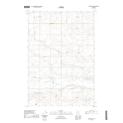
2020 Map of Sandborn Creek
USGS Topo · Published 2020About this map
The Stillwater River winds through the southern portion of this landscape, anchoring a complex system of irrigation infrastructure essential to the region's agricultural history. Dozens of named water-control features, such as the Stillwater Ditch, Larson-Johnson Ditch, and Weir-Crawford Ditch, reveal the extensive engineering used to divert river water across the valley floor. To the south, the flat expanse of Fladberg Bench rises above the river basin, while the north is defined by a series of drainages including Jack Stone Cr and Cow Cr. This network of ditches and rural roads like Madison Grade and Grove Creek Rd illustrates the intersection of natural hydrology and human settlement patterns along the boundary between Sweet Grass and Stillwater counties.
Find a feature on this map
36 named features on this map. Tap any name to fly to it.
Don’t see what you’re looking for? This feature index may not catch every label — zoom into the map to look around manually.
Map Details
Editions of this 2020 Sandborn Creek Map
This is the sole edition of this map. No revisions or reprints were ever made.
Other maps of this area

1891 · Big Timber
USGS Topo · 1:125,000

1892 · Stillwater
USGS Topo · 1:125,000

1893 · Big Timber
USGS Topo · 1:125,000

1898 · Granite Mountain District
USGS Topo · 1:125,000

1932 · Red Lodge No 2
USGS Topo · 1:48,000

1932 · Nye No 1
USGS Topo · 1:48,000

1954 · Billings
USGS Topo · 1:250,000

1955 · Sandborn Creek
USGS Topo · 1:24,000

1955 · Reed Point
USGS Topo · 1:24,000

1955 · Springtime
USGS Topo · 1:24,000