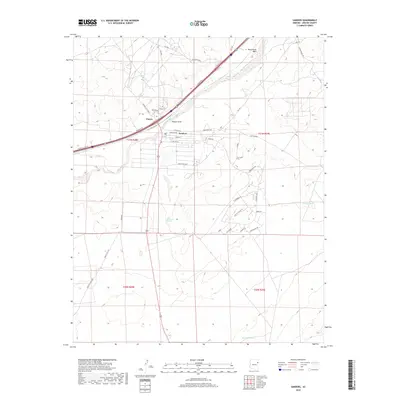
2018 Map of Sanders
USGS Topo · Published 2018About this map
Sanders and the nearby settlement of Chetco sit at a significant intersection of historical and modern transit corridors in Apache County. This high-desert landscape is defined by the drainage of the Puerco River and the sweeping course of Old Rte 66, which runs parallel to the modern frontage roads and rail lines. The terrain is marked by seasonal water features and livestock infrastructure, including Bens Dam Tank, Middle Tank, and the notable Emigrant Springs. Local topography is characterized by deep erosional features like Tolapai Draw and Burntwater Wash, while a network of rural routes such as Claymine Rd and Indian Rte 9402 provide access to the surrounding plateau. The map details the residential layout of the communities and the many small roads, including Crestview and Lakota, that branch into the arid hills.
Find a feature on this map
44 named features on this map. Tap any name to fly to it.
Don’t see what you’re looking for? This feature index may not catch every label — zoom into the map to look around manually.
Map Details
Editions of this 2018 Sanders Map
This is the sole edition of this map. No revisions or reprints were ever made.
Other maps of this area

1886 · Fort Defiance
USGS Topo · 1:250,000

1892 · Fort Defiance
USGS Topo · 1:250,000

1954 · Gallup
USGS Topo · 1:250,000

1958 · Gallup
USGS Topo · 1:250,000

1959 · Gallup
USGS Topo · 1:250,000

1962 · Gallup
USGS Topo · 1:250,000

1967 · Gallup
USGS Topo · 1:250,000

1971 · Burntwater Wash
USGS Topo · 1:24,000
1971 · Sanders
USGS Topo · 1:24,000
1971 · Chambers
USGS Topo · 1:24,000