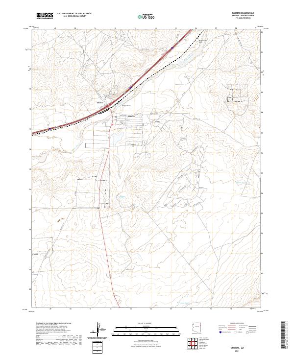
2021 Map of Sanders
USGS Topo · Published 2021About this map
Sanders serves as the primary hub of this high-desert landscape in Apache County, positioned where the modern transportation corridor meets the seasonal flow of the Puerco River. The layout reveals a mix of commercial and residential development organized around Navajo Blvd and Old Rte 66, reflecting the town's historical and continuing role as a transit point. To the west, the settlement of Chetco sits tucked along the Frontage Rd, while the surrounding terrain is defined by dramatic drainage features like Tolapai Draw and Burntwater Wash.
Find a feature on this map
45 named features on this map. Tap any name to fly to it.
Don’t see what you’re looking for? This feature index may not catch every label — zoom into the map to look around manually.
Map Details
Editions of this 2021 Sanders Map
This is the sole edition of this map. No revisions or reprints were ever made.
Other maps of this area

1886 · Fort Defiance
USGS Topo · 1:250,000

1892 · Fort Defiance
USGS Topo · 1:250,000

1954 · Gallup
USGS Topo · 1:250,000

1958 · Gallup
USGS Topo · 1:250,000

1959 · Gallup
USGS Topo · 1:250,000

1962 · Gallup
USGS Topo · 1:250,000

1967 · Gallup
USGS Topo · 1:250,000

1971 · Burntwater Wash
USGS Topo · 1:24,000
1971 · Sanders
USGS Topo · 1:24,000
1971 · Chambers
USGS Topo · 1:24,000