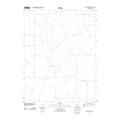
2010 Map of Sanders Ranch
USGS Topo · Published 2010About this map
Wild Horse Creek meanders through this high plains landscape in Cheyenne County, defining the drainage patterns of an area dominated by large-scale ranching and a systematic grid of section roads. The landscape is marked by the presence of Sanders Ranch, a primary focal point of settlement in this part of eastern Colorado. Minor tributaries like Bellyache Creek feed into the larger creek system, illustrating the subtle hydrology of the region. The map reveals a strictly organized infrastructure of agricultural access, where designated routes such as County Road BB and County Road Z provide the necessary links between isolated homesteads and the broader regional network. This survey serves as a clear record of land use and the persistence of the ranching economy at the start of the 21st century.
Find a feature on this map
19 named features on this map. Tap any name to fly to it.
Don’t see what you’re looking for? This feature index may not catch every label — zoom into the map to look around manually.
Map Details
Editions of this 2010 Sanders Ranch Map
This is the sole edition of this map. No revisions or reprints were ever made.
Other maps of this area

1891 · Arroyo
USGS Topo · 1:125,000

1891 · Kit Carson
USGS Topo · 1:125,000

1893 · Arroyo
USGS Topo · 1:125,000

1893 · Kit Carson
USGS Topo · 1:125,000

1954 · Limon
USGS Topo · 1:250,000

1954 · Lamar
USGS Topo · 1:250,000

1957 · Limon
USGS Topo · 1:250,000

1958 · Limon
USGS Topo · 1:250,000

1958 · Lamar
USGS Topo · 1:250,000

1978 · Aroya
USGS Topo · 1:24,000