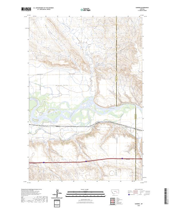
2024 Map of Sanders
USGS Topo · Published 2024About this map
Sanders serves as the primary settlement on this stretch of the Yellowstone River, where the landscape is defined by an extensive network of irrigation infrastructure. The presence of the Yellowstone Canal and Hysham Canal indicates a long-standing reliance on the river's waters to support the agricultural potential of the surrounding valley. North of the river, the terrain rises into the dissected breaks of Mission Valley, characterized by numerous drainages such as Starved to Death Creek and Roach Coulee.
Find a feature on this map
23 named features on this map. Tap any name to fly to it.
Don’t see what you’re looking for? This feature index may not catch every label — zoom into the map to look around manually.
Map Details
Editions of this 2024 Sanders Map
This is the sole edition of this map. No revisions or reprints were ever made.
Other maps of this area

1954 · Forsyth
USGS Topo · 1:250,000

1957 · Forsyth
USGS Topo · 1:250,000

1958 · Forsyth
USGS Topo · 1:250,000

1960 · Hysham
USGS Topo · 1:24,000

1960 · Vananda
USGS Topo · 1:24,000

1960 · Ahles
USGS Topo · 1:24,000

1960 · Sanders
USGS Topo · 1:24,000

1968 · Donleys Reservoir
USGS Topo · 1:24,000

1968 · Finch
USGS Topo · 1:24,000
1971 · Griffin Coulee NW
USGS Topo · 1:24,000