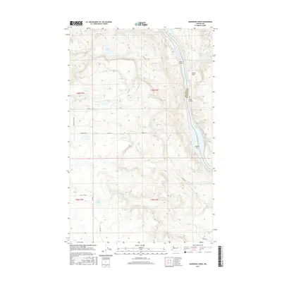
2017 Map of Sanderson Creek
USGS Topo · Published 2017About this map
The Columbia River carves a dramatic border between Douglas and Okanogan counties in this mid-2010s survey, defined by a series of powerful water features including Nespelem Rapids, Equilibrium Rapids, and Monaghan Rapids. The terrain is characterized by significant elevation changes, with Deep Canyon and Kaiser Canyon cutting through the landscape toward the riverbank. This map captures a rural and industrial interface where remote water bodies like Black Lake, Rock Lake, and Smith Lake are connected by a network of local roads such as Siebold Hill Rex Rd and Pendell Rd. The prominence of Sanderson Creek and the river deposits at Buckley Bar highlight the geomorphology of this high-plateau region, providing a detailed look at the hydrology and land use patterns before recent environmental shifts in the Columbia River basin.
Find a feature on this map
29 named features on this map. Tap any name to fly to it.
Don’t see what you’re looking for? This feature index may not catch every label — zoom into the map to look around manually.
Map Details
Editions of this 2017 Sanderson Creek Map
This is the sole edition of this map. No revisions or reprints were ever made.
Other maps of this area

1948 · Grand Coulee Dam
USGS Topo · 1:62,500

1950 · Grand Coulee Dam
USGS Topo · 1:62,500

1950 · Nespelem
USGS Topo · 1:62,500

1950 · Alameda Flat
USGS Topo · 1:62,500

1952 · Alameda Flat
USGS Topo · 1:62,500

1953 · Ritzville
USGS Topo · 1:250,000

1954 · Okanogan
USGS Topo · 1:250,000

1958 · Okanogan
USGS Topo · 1:250,000

1959 · Ritzville
USGS Topo · 1:250,000

1965 · Ritzville
USGS Topo · 1:250,000