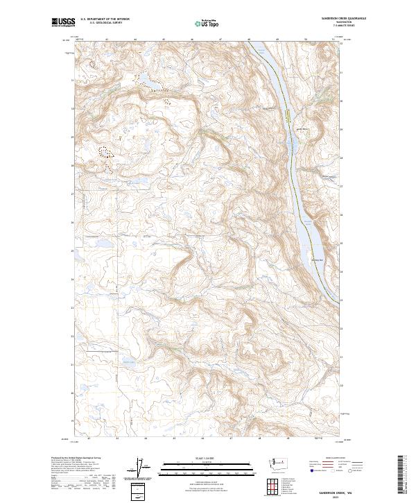
2023 Map of Sanderson Creek
USGS Topo · Published 2023About this map
The Columbia River forms the eastern boundary of this high-plateau landscape, marking the transition from Douglas County to Okanogan County. The river's path is defined by a series of significant whitewater features including Nespelem Rapids, Equilibrium Rapids, and Monaghan Rapids, which dictate the topography of the surrounding Deep Canyon and Bailey Basin. In the western portion of the quadrangle, the land is characterized by numerous small basins and drainages, such as the areas around Sanderson Creek and School Creek. Local hydrology is dotted with small bodies of water like Smith Lake and Rock Lake. The landscape is largely defined by the agricultural and ranching grid, with a network of local thoroughfares including Pendell Rd and Cunningham Rd providing access to the various canyons and bars along the river's edge.
Find a feature on this map
24 named features on this map. Tap any name to fly to it.
Don’t see what you’re looking for? This feature index may not catch every label — zoom into the map to look around manually.
Map Details
Editions of this 2023 Sanderson Creek Map
This is the sole edition of this map. No revisions or reprints were ever made.
Other maps of this area

1948 · Grand Coulee Dam
USGS Topo · 1:62,500

1950 · Grand Coulee Dam
USGS Topo · 1:62,500

1950 · Nespelem
USGS Topo · 1:62,500

1950 · Alameda Flat
USGS Topo · 1:62,500

1952 · Alameda Flat
USGS Topo · 1:62,500

1953 · Ritzville
USGS Topo · 1:250,000

1954 · Okanogan
USGS Topo · 1:250,000

1958 · Okanogan
USGS Topo · 1:250,000

1959 · Ritzville
USGS Topo · 1:250,000

1965 · Ritzville
USGS Topo · 1:250,000