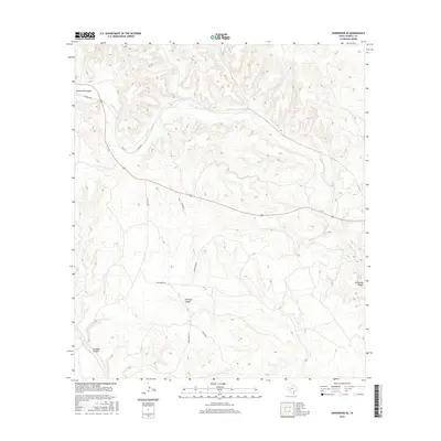
2016 Map of Sanderson SE
USGS Topo · Published 2016About this map
Sanderson Cr carves a deep path through this corner of Terrell County, serving as the primary drainage for the complex system of ravines and draws that define the local geography. The landscape is marked by prominent natural features such as Sanderson Canyon in the northwest and Seminole Canyon near the center, highlighting the transition from high plateaus to the drainage basins below. In the southwest, Isinglass Canyon adds further detail to the intricate terrain. A network of ranch roads and thoroughfares, including Bone Water Rd, Carruthers Rd, and Gatlin Rd, connects these remote areas, reflecting the land use and accessibility of the West Texas backcountry in the early 21st century. These routes follow the natural contours of the land, providing a record of the rural infrastructure maintained within the county.
Find a feature on this map
11 named features on this map. Tap any name to fly to it.
Don’t see what you’re looking for? This feature index may not catch every label — zoom into the map to look around manually.
Map Details
Editions of this 2016 Sanderson SE Map
This is the sole edition of this map. No revisions or reprints were ever made.
Other maps of this area

1918 · Dryden Crossing
USGS Topo · 1:62,500

1918 · Indian Wells
USGS Topo · 1:62,500

1928 · Sanderson
USGS Topo · 1:125,000

1954 · Fort Stockton
USGS Topo · 1:250,000

1958 · Fort Stockton
USGS Topo · 1:250,000

1959 · Emory Peak
USGS Topo · 1:250,000

1965 · Emory Peak
USGS Topo · 1:250,000

1969 · Sanderson SE
USGS Topo · 1:24,000

1969 · Sanderson
USGS Topo · 1:24,000

1969 · Mofeta
USGS Topo · 1:24,000